This road was built to move cars. People live here.
of the ten died in the dark
Ten people were killed walking this corridor between 2022 and 2024. Nine of them after dark.
Paint is cheaper. Lighting is still one of the
easiest things on this list. It has not been done.
It doesn't have to stop being a highway.
Same lanes. Same capacity. Same road doing the same job. The difference is a protected way through for anyone not inside a car.
Conceptual cross-section, drawn to show relative width — not an engineering drawing. Treatment types, dimensions and crossing location would require analysis by SCDOT.
This road is not an outlier. It is the pattern.
South Carolina's national rank for pedestrian deaths.
People killed while walking in South Carolina, 2020–2024.
Charleston's rank among the deadliest US metros — the nearest big city to where my father was killed.
People killed walking in the United States in 2024.
Rise since 2009 — outpacing both population and miles driven.
Share of all US road deaths that are people on foot. A new high.
We said the map was wrong.
They changed it.
Somehow this page landed in front of Jim Hemphill, Southeast Manager for the East Coast Greenway Alliance. He reached out. He listened. And then he actually fixed it.
The map used to show the trail with real protected space between users and US 17. It doesn't have that. In some areas there's only about three feet, dividing pedestrians and riders from a 55 mph road. Jim corrected the data. The map now shows what is actually there.
That matters most for people who aren't from here: anyone planning the Maine-to-Florida route, looking at a map, trusting what they see. Now they will know to be careful on that stretch.
Details fall through the cracks. Small ones, important ones. What matters is that they can be corrected — and that someone did.
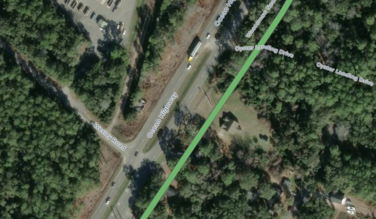
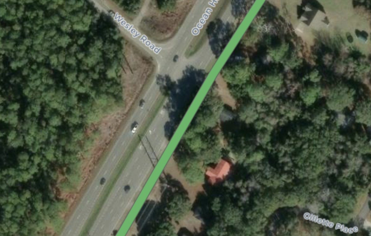
map.greenway.org at Wesley Road and US 17, before and after. The two views are separate screenshots taken weeks apart, so the zoom is not identical — but it is the same intersection, and the line has moved onto the road.
Complete isn't the same as safe.
And that's the point.
A trail can be finished on a map and still be three feet of pavement beside traffic doing 55. Those are two different questions. Only one of them has been answered on this stretch of road.
This is the road today. This is the road we are asking for.
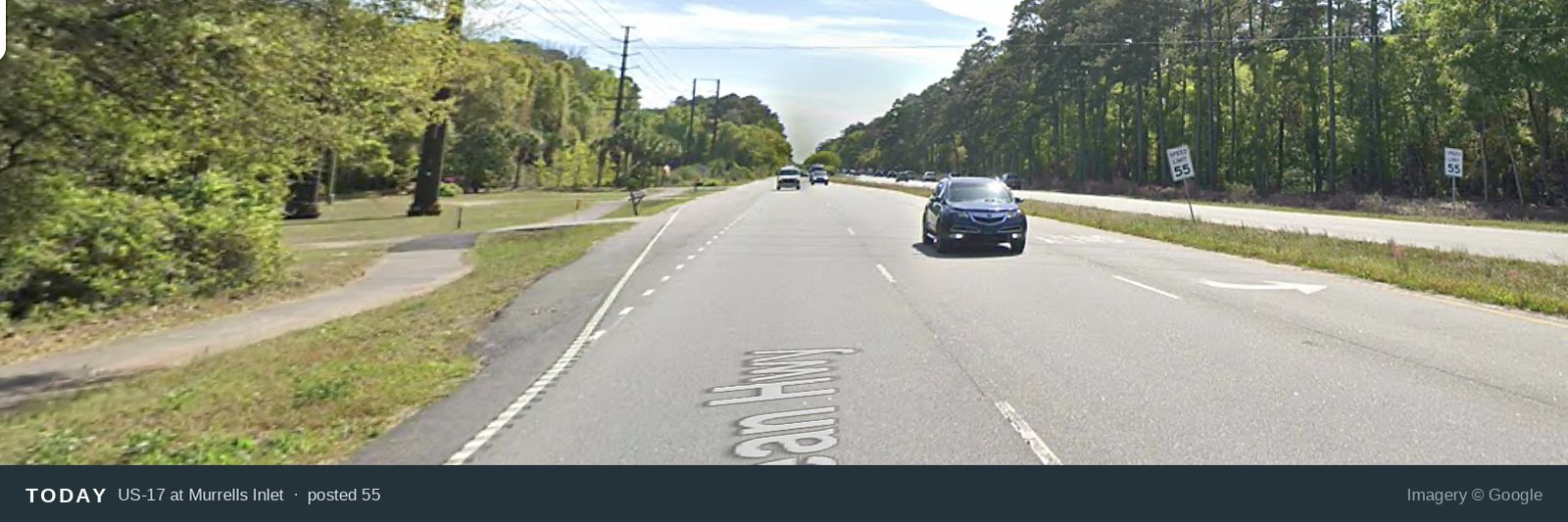
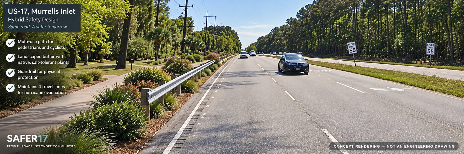
Same camera, same stretch of road, same four lanes — because US 17 is a hurricane evacuation route and that is not up for discussion. What moves is the path: back behind planting and a guardrail, instead of a strip of grass. This is a concept, not a plan. Photograph: imagery © Google.
Orlando was one of the deadliest cities in America. Then it wasn't.
It sat for years in the twenty worst places in America for people on foot. It is now No. 25 — one of the largest drops in the country. Six things did it, and four of them could start on US 17 tomorrow.
Nine of ten deaths after dark
Lit the corridor
NowCrossings unmarked, so drivers don't yield
Marked and signalled every crosswalk
NowThe worst spots are known and untouched
Fixed schools and speed problems first
NowWork follows complaints, not crashes
Let crash data set the order
NowTwo to three miles between crossings
Added places to cross
NextDrivers see a highway, not a neighbourhood
Made the road look like somewhere people live
Longer- NowPaint, fixtures, decisions.
- NextDesign and funding.
- LongerChanges the shape of the road.
Hoboken, New Jersey has gone nine straight years without a single traffic death. Jersey City reached zero too. None of this is theoretical.
Washington already agrees with us.
In April 2026 NHTSA launched Pathways to Safer Streets, a national traffic safety action plan. Two of its eight strategies are things we have been asking South Carolina for since 2024.
-
Intelligent Speed Assistance for repeat offenders
NHTSA says it is prioritising the “worst of the worst” and explicitly names speed-limiting devices for repeat offenders. That is the Stop Super Speeders ask, in the federal government's own plan.
-
Safe Streets and Roads for All grants
A live USDOT funding stream. Corridor lighting and crossing installation are precisely what it exists to pay for.
Which removes the last excuse. The policy is agreed and the money exists.
What's missing is a state agency willing to apply either one to fifteen miles of road in Georgetown County.